
Intro
-
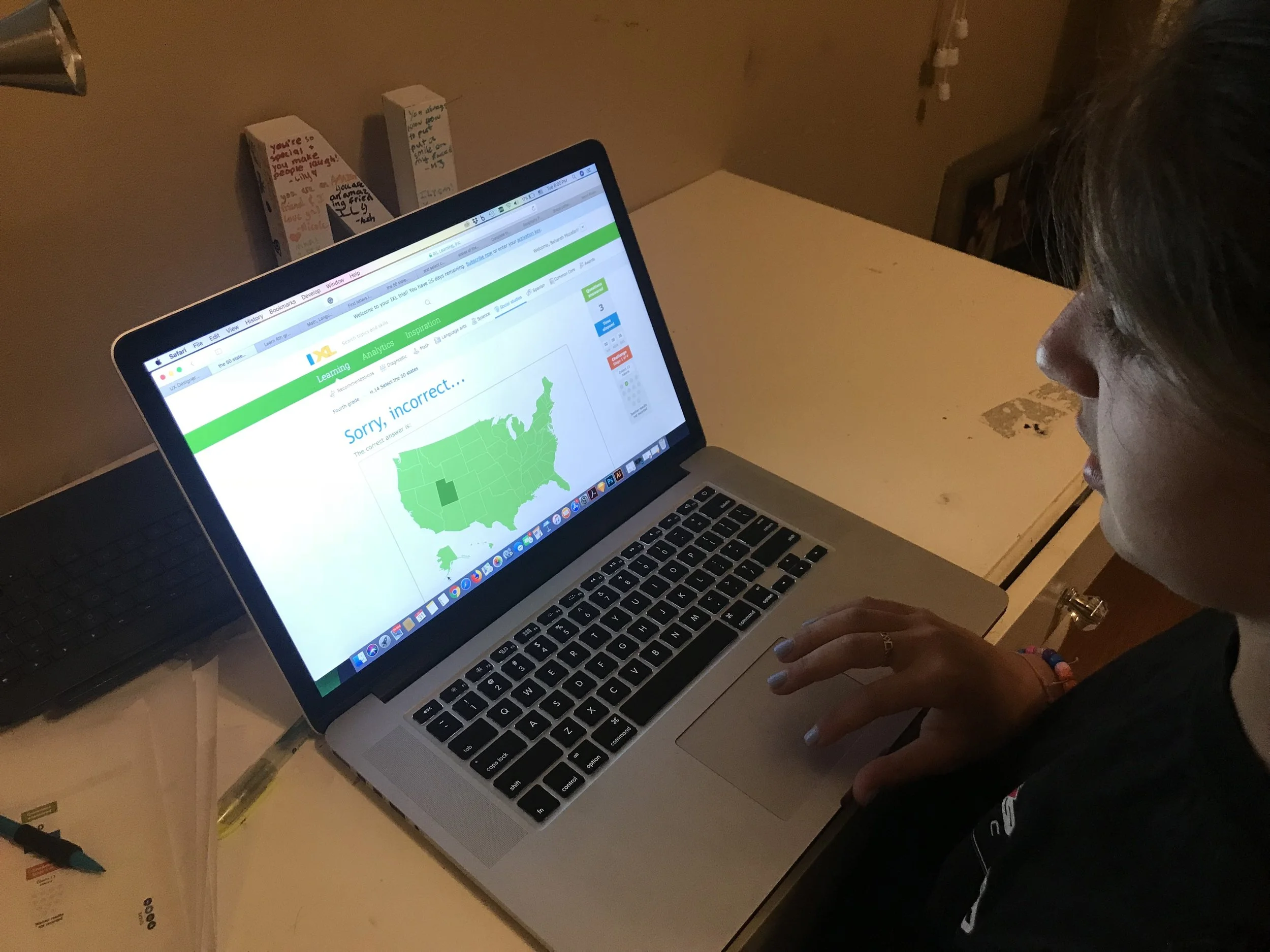
IXL Learning is an American education company based on learning. They offer educational practice for K-12th graders in different practice skills for math, language arts, science, social studies, and Spanish. They also provides analytical tools to track student and classroom performance and identify areas for academic improvement with each student.

Design question
-
In each question, students will be given a map of the United States showing outlines of the 50 states. They will also be given the names of 4 to 10 regions. Students will be tasked with assigning the states on the map to the regions provided. Each state can only belong to one region, and each region will contain at least 2 states. Regions may be noncontiguous.
How might we design questions in an efficient way that help students understand the different ways the United States may be organized into regions?

Research
-
Understanding the IXL Learning products
As a starting point, I used the free IXL trial to test out and better understand how the questions are structured in different topics. Then I assigned practice H to my two nieces in fourth and fifth grades and observed them taking the test. I noticed that they use the process of elimination to find the correct answers. In addition, incorrectly answered questions appeared more than once to ensure that the student learned the correct responses based on previous mistakes.


Ideations
-
I then started brainstorming and putting ideas on paper. After sketching multiple concepts for the interactive questions, I narrowed down the options based on strengths and feasibility of each concept.

Design solution
-
How I designed the questions
I designed two stages with two different types of questions:
The student is given a list of state names and is asked to select the ones within the highlighted region shown on the map
The student is given the name of a specific region on the map and is asked to highlight the boundaries of that region on the map.
*Note: For designing the questions, I used the layout they provided me.
Stage 1/

Questions Type 1
Note: There are always repeated choices from the previous question so that
the students can use the process of elimination to find the correct answers.
This question type will continue till all the region covered.
Question

Answer


Stage 2/
After all regions are covered, the students move on to stage 2 where they have to select the correct states on the map based on the name of the region.

Question Type 2
Note: This question type will be continued until all the regions are covered. Some of the questions will randomly repeat if an incorrect answer was provided to ensure that the student masters the topic prior to moving onto the next stage.
Question
Answer


Paper Prototyping & validating
-
To validate the design, I printed the paper versions of the two question types and asked my nieces to take the test. For the incorrectly answered questions, the correct responses were provided, and they were asked to answer the same question in a random order until they demonstrated that they have fully learned the topic.

Key Finding
The users completed type 1 questions in stage 1 without an issue. However, they struggled with type 2 questions on stage 2 since the higher quantity of selections in each region created a greater chance of making a mistake compared to stage 1.
Iterations
-
To resolve this issue, I revised the design so that the students are given a cluster of highlighted states and are asked to click on the states that don't belong to that region. To validate my new design, I conducted another round of user testing with printed prototypes and the results were satisfactory this time.
Before
After
